

Mudsock, Ohio
What a Name
Mudsock. What a strange name for a community! There’s two legends about how this small community southwest of Hilliard got its name. First, it’s said that “a farmer, traveling through the muddy area on horseback, dismounted to give his animal a rest. The farmer stepped into the thick mire and found that he couldn’t” pull out his feet. “First off came his shoe, and then his sock, both stuck fast in the” mud. “Whatever happened to the farmer, no one remembers, but the tale of the sock in the mud passed on through generation of residents, who told the tale as an explanation of their community’s name” (p. 29 in the article below).
The other story of Mudsock’s name includes a wetland, also. Residents say that the horses always had mud on their legs, which looked just like brown socks. Which legend is true? We will probably never know. Which story do you like better?
About Mudsock
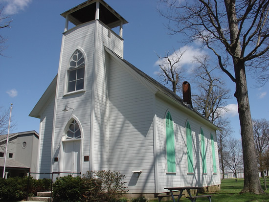
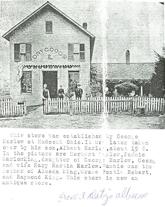
Mudsock, which was only one mile wide, stretched east around the area which is today the intersection of Roberts Road and Alton Darby Creek Road. And it only lived for about 100 years. It started first as corn fields with a few farms in 1830, and then by 1850 the population had grown to 681 people. The community included a school for African American children and the Darby post office. But as Columbus grew and grew, it took over much of the area. By the 1950’s, when the name Mudsock disappeared from maps, all that was left was 15 people, a dry goods store, a county truck garage, and the Colwell Methodist Church. Today, none of those buildings are left except for the Colwell Methodist Church which was moved to the Historical Village.
More Information & Primary Sources
- Primary
- Articles
- Image
- Charts
- Artifact
- Link
- Map
References
Adapted by Christina Dorr, Library Media Specialist, Hilliard City School District
Rewritten from “Mudsock, We Hardly Knew You: Ohio’s Essential Podunk” by Randy McNutt, published in Ohio Magazine in the June, 1994 issue.